)
)
)
)
)
)
)
)


 20190504")
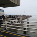
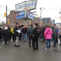
On land @JanesWalkTO led by @JohnLorinc "A Meandering History of the Lower Don" that was Ashbridges Bay Marsh before landfill. Cherry Street would have been part of the Don River delta, before the waterway was channelled further east, with an unnatural 90-degree turn as the Keating Channel in the late 1890s. The combination of industrial waste and human excrement combined into public health hazard, corrected with conversion into a massive industrial district from 1912-1922. Today, the Gooderham and Worts site has been redeveloped into the Distillery District. (Distillery Lane, Distillery District, Toronto, Ontario) 20190504
- Copyright
- CC-BY
- Author
- daviding
- Created on
- Saturday 4 May 2019
- Posted on
- Saturday 4 May 2019
- Dimensions
- 4320*2880
- File
- IMG_7830.JPG
- File size
- 4626 KB
- Albums
- Visits
- 5336
0 comments